East Stour
East Stour is a small ancient Dorset village with an area of 1,786 acres and a population of approximately 500 situated around 5 miles west of Shaftesbury. Over the centuries agriculture has provided employment for men, women, children and itinerant workers until the advent of tractors and mechanisation. In 1085 the Domesday Book recorded and taxed 17 hides in East Stour and West Stour and with mills, pasture and meadow it was already an established village. A century ago, to supplement meagre incomes, women of East Stour made gloves for companies in neighbouring Gillingham and buttons for suppliers in Shaftesbury. The parish church of Christ Church was rebuilt in 1841-42.
The East Stour Village website (East Stour Village Hall - Sheila Squire 01747 838488) and East Stour Facebook page have more information.
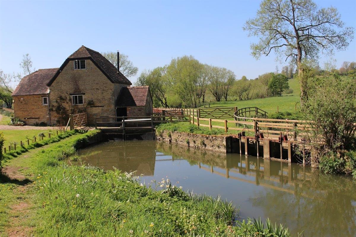
Stour Provost
Stour Provost village is at the western edge of the parish, clustered on a rise that slopes down to the River Stour. The Mill on the river is mentioned in the Domesday Book of 1086 and for a time following the Norman Conquest the village and church belonged to a Normandy nunnery, but for 500 years until 1925 much of the land and houses were owned by King’s College, Cambridge. The Church of St Michael and All Angels dates from the 13th or 14th century and is Grade 1 listed. The streets and village have changed little in recent decades and include many fine buildings. Indeed, several writers have considered the centre of the village as one of the most attractive in north Dorset
Stour Row
Stour Row is situated beside Duncliffe Hill 3 miles (4.8 km) southwest of Shaftesbury. It lies within the parish of the neighbouring village of Stour Provost. Stour Row has approximately 150 houses and 300 residents. It has a village hall which is used to run regular social events. Today it has few other amenities but it had a petrol station, pub and shop prior to the early 1980s. It has a church, All Saints, which was built in 1868 but which has now closed due to falling congregation numbers. The last service was held in the church on 15 October 2015. Stour Row lies within the SP7 postcode area on the edge of the Blackmore Vale.
Todber
Todber is a small parish, covering 378 acres and with a population of 140 at the Census in 2011. The Parish Church of St Andrew was rebuilt, with the exception of the tower, in 1879, by Elizabeth Marchioness of Westminster. The tower contains bells dated 1736-7, one of which was recast in 1879. The register dates from 1653. The main commercial activity in the Parish is farming, with a coarse fishery business established at Todber Manor, providing recreational facilities and holiday cottages.
Residents of Todber are receiving parish notices by e-mail via 'mailchimp'. If you would like to sign up to the circulation list please click here or email your request to Todber.parish@gmail.com
West Stour
West Stour is a picturesque village and civil parish nestled in the scenic Blackmore Vale, located on the River Stour, five miles south of Gillingham. The village is home to dairy farms, a church, a village hall, a historic public house, a large equestrian showground, a garage, a large service station and shop on the A30 road between the towns of Shaftesbury and Sherborne. Historically significant, West Stour was mentioned in the Domesday Book of 1086. The parish church, St. Mary’s, is a Grade II* listed building with origins in the 13th century, though it underwent major reconstruction in 1840. The village’s open fields were enclosed in 1779, marking a key development in its agricultural history. The Grade II listed public house was traditionally a coaching inn used to change the Royal Mail horses before completing the climb to the hill top town of Shaftesbury.
West Stour Parish residents are receiving Parish notices via email, if you would like to sign up to the circulation list please click here. For West Stour Village Hall Bookings please contact – Mrs Viv Jeffery 01747 838245.